View Larger Map

Our Current Voyage

Mooloolaba, QLD to Sydney, NSW to meet Jessica & Ella's Pink Lady.

Click HERE to see we are.

RESULTS

New Plymouth to Mooloolaba, Solo Trans-Tasman Challenge 2010

Click HERE for the Race Site.

Wednesday, April 22, 2009

Back to Recherche Bay

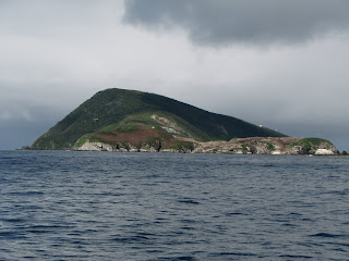
East Pyramids, Port Davey TAS
South West Cape TAS
Maatsuyker Island TAS
South East Cape TAS

POS S -43 33.965’
E +146 53.593’

13th March 2009

Departed Spain Bay @ 0630 with a stream of Circumnavigation boats all motoring out into Port Davey in the dark. Motored until just before East Pyrmids then pulled up the mainsail and motor sailed. Passed SW Cape @ 0845, and still NO WIND. Had to motor all the way to Recherche Bay, it either feast or fame with the wind down here in Tassie. Lots of weed to dodge and off Whale Head we hit a large patch of weed and damaged the stbd outboard impellor. Headed around into Snake Point, Recherche Bay arriving @ 1615 and anchored in shallow water. Bruce and Tom jumped into in the dinghy and pulled the bottom of the stbd outboard and changed the impellor. One hour later the stbd outboard was back in action and we moved over into Coalbins Bay, Recherche Bay @ 1755, covering 70.1 nm in 9 hrs 57 mins @ AVE 7.0 kts.
Monday, April 6, 2009

Spain Bay – Port Davey

Clayton's Corner, Bathurst Harbour TAS
Clayton's Corner
Tom @ TV Hill (Mt Rugby - Background)
Spain Bay, Port Davey Harbour TAS

12th March 2009


R & R Day post Mt Rugby Climb. Had a good sleep in and awoke with very stiff and sore leg muscles. Spent the night in Claytons Corner with boats from the 2009 Van Diemen’s Land Circumnavigation. Went ashore and visited the Clayton House and Jetty.
Had a short walk up the nearby TV Hill to stretch our legs. Meet up with people from the Tasmanian Parks and Wildlife doing a park visitor survey. Left Claytons Corner heading for Spain Bay in Port Davey. Time to leave before the weather changes and traps us. Spent the night with 20 other boats from the Round Tassie fleet all with the same idea.
What an amazing couple of days in a very special hard to reach part of the world, well worth the visit. We will be back to spend more time in here in the future.

Mt Rugby Climb Instructions

Mt Rugby, Bathurst Channel TAS
Mt Rugby Climb START

Mt Rugby 1st Ridge

Bathurst Harbour
Climbing Mt Rugby is a challenging excursion with 2,534 feet (or 772m) of vertical-up and is not for the fainthearted. On a good day, the view from the top is one of the finest in Tasmania, if not the world.

Leave the dinghy at the beach in the little cove across the channel from, and NE of, Iola Bay. Head NW and pick up the track along the top of the razor back ridge leading you N up to the first saddle. NOTE that this part of the track is quite steep, slippery and treacherous – especially when tired legs are returning downhill. Like most such tracks in SW Tasmania they are kept open by passing wombats. Parts of this are more like a knee-high tunnel so you cannot see your feet – they have to be put one in front of the other, not side by side.

From the saddle, the route turns NW around and through some rocky outcrops. Once through them, in dry summer weather, under a very large boulder you will find the last accessible fresh water. From here the route sidles round the E face of the mountain and the summit is approached from the NE. The last hundred (vertical) feet is around, over and through a mass of boulders and brush-filled cracks.

Mt Rugby Climb

Tom & Leanne - 1st Ridge Mt Rugby
Frog Hollow (BWR), Bathurst Channel

Bathurst Channel/Port Davey Harbour

The TOP of Mt Rugby

11th March 2009

Up early @ 0730 for a visual weather check, its ON, Mt Rugby is clear. All systems go!!
A breakfast of porridge was eaten; our packs with food, chocolate, drinks and warm clothing were packed. Into the dinghy and off we went motoring from Eve’s Point (Frog Hollow) across the Bathurst Channel to a little cove with a small beach. Suzanne sighted a Pot-Bellied Seahorse in the fresh tannin water layer. Climbing commence @ 0900 and took four hours to reach the top. It was a steep narrow, wet muddy track but well worth the effort. The views of Port Davey and Bathurst Harbour were awesome, a highlight of the trip. Downhill was a long and slow trip, on much tried legs. Lots of falls, either sitting on our bums or toppling over on our sides, no injuries except for stiff sore legs. No snakes sighted either – bugger. Arrived back at the boat, @1600 for hot showers. Upped anchor and shifted into Claytons Corner in Bathurst Harbour.

Port Davey or BUST

Coal Bluff, South Cape Bay
Furthest South, S/E Cape
Entrance of Bathurst Channel
BWR @ Frog Hollow, Bathurst Channel
Mt Rugby in Background
POS S -43 20.870’
E +146 06.140’

10th March 2009

Early start this morning @ 0650 first light, heading for Port Davey, wind W 10 kts 100% cloud cover with .5m wind wave and 1m SW low swell, sea smooth. Departed Rocky Bay inside Recherche Bay motor sailing with mainsail using one motor at a time to conserve fuel. Sighted Pedra Branca (Eddystone Rock) way out to sea, 13.5 nm away. Rounded South East Cape (Pos -43 38.575’ S, +146 49.587’ E) @ 0830, the furthest South in Tasmania/Australia. Sighted the Coal Bluff @ 0920 in South Cape Bay, our walk destination from yesterday. Motors off and finally sailing with Main & Jib. Passed Maasuker Island @ 1150, motors ON again. Rounded South West Cape @ 1330 and arrived at the Port Davey Entrance @ 1550. Entered Bathurst Channel and dropped anchor around Eve’s Point in Frog Hollow @ 1700 after covering 80.9 nm in 10 hrs 10 mins @ AVE 7.9 kts.